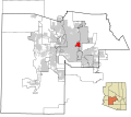
Datei:Maricopa County Incorporated and Planning areas Paradise Valley highlighted.svg

Größe der PNG-Vorschau dieser SVG-Datei: 694 × 599 Pixel. Weitere aus SVG automatisch erzeugte PNG-Grafiken in verschiedenen Auflösungen: 278 × 240 Pixel | 556 × 480 Pixel | 889 × 768 Pixel | 1.185 × 1.024 Pixel | 2.371 × 2.048 Pixel | 940 × 812 Pixel
Originaldatei (SVG-Datei, Basisgröße: 940 × 812 Pixel, Dateigröße: 1,05 MB)
Dateiversionen
Klicke auf einen Zeitpunkt, um diese Version zu laden.
| Version vom | Vorschaubild | Maße | Benutzer | Kommentar | |
|---|---|---|---|---|---|
| aktuell | 08:38, 20. Mai 2011 |  | 940 × 812 (1,05 MB) | Ixnayonthetimmay | Uploading new version |
| 06:33, 30. Aug. 2008 |  | 900 × 800 (413 KB) | Ixnayonthetimmay | == Summary == {{Information |Description=This map shows the incorporated areas and unincorporated areas in Maricopa County, Arizona. [[:en:Paloma, Arizona|Pa | |
| 02:11, 16. Sep. 2007 |  | 900 × 800 (384 KB) | Ixnayonthetimmay | {{Information |Description= |Source= |Date= |Author= |Permission= |other_versions= }} | |
| 12:09, 28. Mai 2007 |  | 900 × 780 (329 KB) | Ixnayonthetimmay | ||
| 02:53, 22. Mai 2007 |  | 900 × 780 (318 KB) | Ixnayonthetimmay | ||
| 07:20, 30. Jan. 2007 |  | 904 × 758 (177 KB) | Ixnayonthetimmay | {{Information |Description=This map shows the incorporated areas in Maricopa County, Arizona, highlighting Paradise Valley in red. It also shows the boun |
Dateiverwendung
Die folgende Seite verwendet diese Datei:
Globale Dateiverwendung
Die nachfolgenden anderen Wikis verwenden diese Datei:
- Verwendung auf ar.wikipedia.org
- Verwendung auf arz.wikipedia.org
- Verwendung auf ca.wikipedia.org
- Verwendung auf cy.wikipedia.org
- Verwendung auf et.wikipedia.org
- Verwendung auf eu.wikipedia.org
- Verwendung auf fa.wikipedia.org
- Verwendung auf fr.wikipedia.org
- Verwendung auf ht.wikipedia.org
- Verwendung auf it.wikipedia.org
- Verwendung auf pt.wikipedia.org
- Verwendung auf sh.wikipedia.org
- Verwendung auf sr.wikipedia.org
- Verwendung auf tt.wikipedia.org
- Verwendung auf vo.wikipedia.org
- Verwendung auf www.wikidata.org
- Verwendung auf zh-min-nan.wikipedia.org