Datei:Cherkasy province location map.svg

Größe der PNG-Vorschau dieser SVG-Datei: 533 × 447 Pixel. Weitere aus SVG automatisch erzeugte PNG-Grafiken in verschiedenen Auflösungen: 286 × 240 Pixel | 572 × 480 Pixel | 916 × 768 Pixel | 1.221 × 1.024 Pixel | 2.442 × 2.048 Pixel
Originaldatei (SVG-Datei, Basisgröße: 533 × 447 Pixel, Dateigröße: 137 KB)
![]()
Diese Datei und die Informationen unter dem roten Trennstrich werden aus dem zentralen Medienarchiv Wikimedia Commons eingebunden.
![]()
Beschreibung
| Beschreibung |
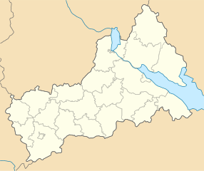
English: Location map of Cherkasy province, Ukraine
Русский: Позиционная карта Черкасской области, Украина
Українська: Карта Черкаської області, Україна |
| Datum | |
| Quelle | Eigenes Werk |
| Urheber | Urutseg |
| SVG‑Erstellung |
Lizenz
| Ich, der Urheberrechtsinhaber dieses Werkes, veröffentliche es als gemeinfrei. Dies gilt weltweit. In manchen Staaten könnte dies rechtlich nicht möglich sein. Sofern dies der Fall ist: Ich gewähre jedem das bedingungslose Recht, dieses Werk für jedweden Zweck zu nutzen, es sei denn, Bedingungen sind gesetzlich erforderlich. |
Dateiversionen
Klicke auf einen Zeitpunkt, um diese Version zu laden.
| Version vom | Vorschaubild | Maße | Benutzer | Kommentar | |
|---|---|---|---|---|---|
| aktuell | 11:29, 29. Jun. 2014 | | 533 × 447 (137 KB) | קרלוס הגדול | lighter borders between provinces |
| 20:30, 6. Dez. 2010 |  | 533 × 447 (137 KB) | Urutseg |
Dateiverwendung
Die folgende Seite verwendet diese Datei:
Globale Dateiverwendung
Die nachfolgenden anderen Wikis verwenden diese Datei:
- Verwendung auf ar.wikipedia.org
- Verwendung auf be.wikipedia.org
- Чаркасы
- Умань
- Тальнэ
- Сміла
- Хрыстыніўка
- Шрамкіўка
- Шаблон:На карце/Украіна Чаркаская вобласць
- Звэныгародка
- Букы
- Вэрхнячка
- Еркы
- Катэрынопіль
- Цыбуліў
- Манькіўка
- Лысянка
- Цвітковэ
- Стэбліў
- Сэмэніўка (Лысянскі раён)
- Навасілка (Манастырышчэнскі раён)
- Ямпіль (Катэрынопільскі раён)
- Чэрэпын (Корсунь-Шэўчэнкіўскі раён)
- Навэ Міста (Манастырышчэнскі раён)
- Verwendung auf bg.wikipedia.org
- Verwendung auf ceb.wikipedia.org
- Verwendung auf es.wikipedia.org
- Verwendung auf fa.wikipedia.org
- Verwendung auf he.wikipedia.org
Weitere globale Verwendungen dieser Datei anschauen.