Datei:C78192s1 Ant.Map Mount Discovery.jpg

Größe dieser Vorschau: 602 × 600 Pixel. Weitere Auflösungen: 241 × 240 Pixel | 482 × 480 Pixel | 771 × 768 Pixel | 1.028 × 1.024 Pixel | 2.055 × 2.048 Pixel | 3.080 × 3.069 Pixel
Originaldatei (3.080 × 3.069 Pixel, Dateigröße: 2,34 MB, MIME-Typ: image/jpeg)
![]()
Diese Datei und die Informationen unter dem roten Trennstrich werden aus dem zentralen Medienarchiv Wikimedia Commons eingebunden.
![]()
| Beschreibung |
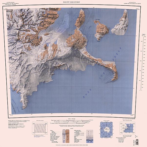
English: Map of Antarctica by the United States Antarctic Resource Center of the US Geological Society. |
| Quelle | USGS |
| Urheber | USGS |
Dieses Bild ist gemeinfrei (public domain), weil es Materialien beeinhaltet, die ursprünglich vom United States Geological Survey, einer Behörde des Innenministeriums der Vereinigten Staaten, stammen. Weitere Informationen finden Sie in den Urheberrechtsbestimmungen des USGS
|
Dateiversionen
Klicke auf einen Zeitpunkt, um diese Version zu laden.
| Version vom | Vorschaubild | Maße | Benutzer | Kommentar | |
|---|---|---|---|---|---|
| aktuell | 20:12, 23. Nov. 2015 | | 3.080 × 3.069 (2,34 MB) | ValeriySh | Обрізка зайвого поля |
| 11:51, 4. Apr. 2005 |  | 4.358 × 3.253 (1,44 MB) | Achim Raschka | Map of Antarctica by the United States Antarctic Ressource Center of the US Geological Society. {{PD-US}} Copyrights and Trademarks USGS-authored or produced data and information are in the public domain. While the content of most USGS web pages is in th |
Dateiverwendung
Die folgenden 52 Seiten verwenden diese Datei:
- Antarktische Trockentäler
- Bishop Peak
- Black Island (Ross-Archipel)
- Bowden-Gletscher
- Bratina-Lagune
- Bratina Island
- Brown-Halbinsel
- Cape Spirit
- Denton Hills
- Dreary Isthmus
- Eastface-Nunatak
- Hahn Island
- Heald-Insel
- Isolation Point
- Johns Hopkins Ridge
- Kap Beck
- Kap Hodgson
- Kap Spencer-Smith
- Koettlitz-Gletscher
- Lake Cole
- Marshall Valley
- Minna Bluff
- Minna Hook
- Minna Saddle
- Moraine Bluff
- Moraine Strait
- Mount Aurora
- Mount Hayward
- Mount Heine
- Mount Henderson (White Island)
- Mount Melania
- Mount Nesos
- Mount Nipha
- Mount Nubian
- Mount Ochre
- Mount Rucker
- Mount Vision
- Rainbow Ridge
- Red Dike Bluff
- Ross-Orogen
- Royal Society Range
- Rucker Ridge
- Rutgers-Gletscher
- Salient Ridge
- Scallop Hill
- Shults-Halbinsel
- Skelton-Gletscher
- The Bulwark
- Ward Lake
- White Island (Ross-Archipel)
- White Strait
- Diskussion:Borg Bastion
Globale Dateiverwendung
Die nachfolgenden anderen Wikis verwenden diese Datei:
- Verwendung auf bg.wikipedia.org
- Verwendung auf ceb.wikipedia.org
- Verwendung auf en.wikipedia.org
- Skelton Glacier
- Royal Society Range
- Koettlitz Glacier
- White Island (Ross Archipelago)
- Black Island (Ross Archipelago)
- Miers Valley
- Minna Bluff
- Mount Lister
- Ward Valley
- Brown Peninsula
- Denton Hills
- The Pyramid (Antarctica)
- Péwé Peak
- Garwood Valley
- Harvey Summit
- Marshall Valley
- Keble Hills
- Rampart Ridge
- Blue Glacier (Antarctica)
- Mount Rücker
- Hidden Valley (Antarctica)
- Mount Dromedary (Antarctica)
- Table Mountain (Antarctica)
- Verwendung auf fr.wikipedia.org
- Verwendung auf he.wikipedia.org
- Verwendung auf it.wikipedia.org
- Ghiacciaio Blue
- Ghiacciaio Koettlitz
- Ghiacciaio Adams (Terra Vittoria)
- Ghiacciaio Allison
- Ghiacciaio Cocks
- Ghiacciaio Potter
- Ghiacciaio Wirdnam
- Ghiacciaio Rutgers
- Ghiacciaio Dale
- Ghiacciaio Glimpse
- Ghiacciaio Kempe
- Ghiacciaio Pipecleaner
- Ghiacciaio Radian
- Ghiacciaio Howchin
- Ghiacciaio Walcott
- Ghiacciaio Salient
- Ghiacciaio Hooker
Weitere globale Verwendungen dieser Datei anschauen.