Datei:Sand Mountain volcanic field.jpg
Es ist keine höhere Auflösung vorhanden.
Sand_Mountain_volcanic_field.jpg (640 × 422 Pixel, Dateigröße: 32 KB, MIME-Typ: image/jpeg)
![]()
Diese Datei und die Informationen unter dem roten Trennstrich werden aus dem zentralen Medienarchiv Wikimedia Commons eingebunden.
![]()
| Beschreibung |
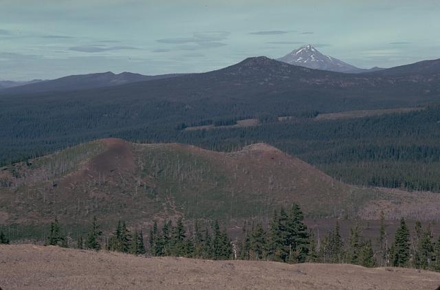
English: The Sand Mountain volcanic field contains a group of 23 cinder cones erupted along a N-S line NW of Mount Washington.
|
|||
| Datum | ||||
| Quelle | http://www.volcano.si.edu/world/volcano.cfm?vnum=1202-04-&volpage=photos&photo=030029 | |||
| Urheber | Lee Siebert (Smithsonian Institution) | |||
| Genehmigung (Weiternutzung dieser Datei) |
|
Dateiversionen
Klicke auf einen Zeitpunkt, um diese Version zu laden.
| Version vom | Vorschaubild | Maße | Benutzer | Kommentar | |
|---|---|---|---|---|---|
| aktuell | 18:00, 27. Mai 2010 | | 640 × 422 (32 KB) | Michael Metzger | {{Information |Description={{en|1=The Sand Mountain volcanic field contains a group of 23 cinder cones erupted along a N-S line NW of Mount Washington. Two cone alignments diverge at the highest cone, Sand Mountain; this view looks along the NNE alignment |
Dateiverwendung
Die folgende Seite verwendet diese Datei:
Globale Dateiverwendung
Die nachfolgenden anderen Wikis verwenden diese Datei:
- Verwendung auf en.wikipedia.org
- Verwendung auf no.wikipedia.org
- Verwendung auf pt.wikipedia.org
- Verwendung auf www.wikidata.org