Datei:Planes trains automobiles route map.svg

Größe der PNG-Vorschau dieser SVG-Datei: 357 × 297 Pixel. Weitere aus SVG automatisch erzeugte PNG-Grafiken in verschiedenen Auflösungen: 289 × 240 Pixel | 577 × 480 Pixel | 923 × 768 Pixel | 1.231 × 1.024 Pixel | 2.462 × 2.048 Pixel
Originaldatei (SVG-Datei, Basisgröße: 357 × 297 Pixel, Dateigröße: 196 KB)
![]()
Diese Datei und die Informationen unter dem roten Trennstrich werden aus dem zentralen Medienarchiv Wikimedia Commons eingebunden.
![]()
Beschreibung
| Beschreibung |
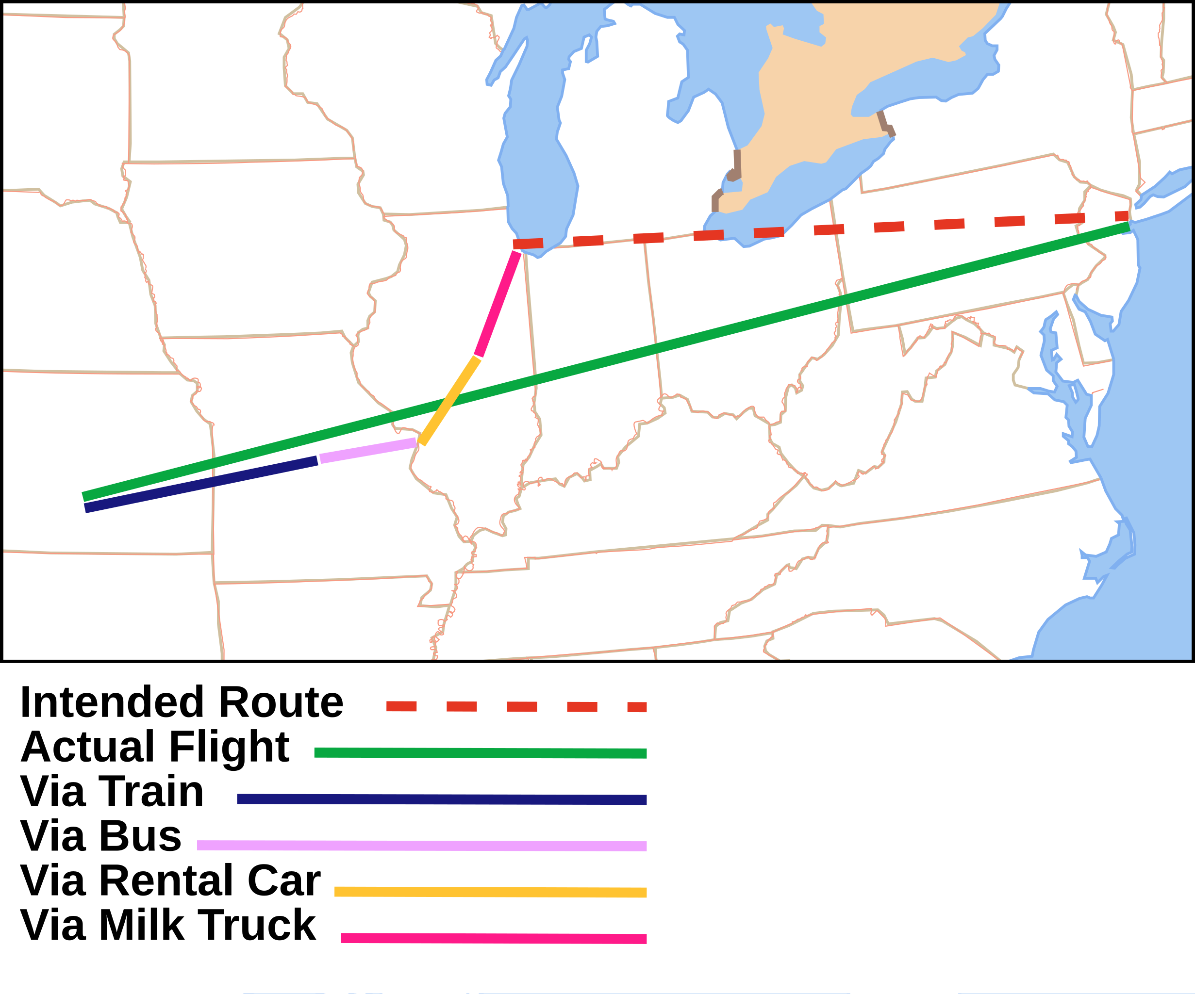
English: Route taken by Del Griffin and Neal Page in the movie Planes, Trains and Automobiles
|
||
| Datum | |||
| Quelle | Own based on: File:Map of USA without state names.svg | ||
| Urheber |
Vektor: |
||
| Genehmigung (Weiternutzung dieser Datei) |
Ichabod, der Urheberrechtsinhaber dieses Werkes, veröffentlicht es hiermit unter der folgenden Lizenz: Diese Datei ist unter der Creative-Commons-Lizenz „Namensnennung – Weitergabe unter gleichen Bedingungen 3.0 nicht portiert“ lizenziert. Namensnennung: Ichabod
Du darfst es unter einer der obigen Lizenzen deiner Wahl verwenden. |
||
| SVG‑Erstellung |

Dateiversionen
Klicke auf einen Zeitpunkt, um diese Version zu laden.
| Version vom | Vorschaubild | Maße | Benutzer | Kommentar | |
|---|---|---|---|---|---|
| aktuell | 05:59, 8. Jul. 2024 | | 357 × 297 (196 KB) | TheWanderingTraders | == {{int:filedesc}} == {{Information |Description={{en|1=Route taken by Del Griffin and Neal Page in the movie Planes, Trains and Automobiles * Red dotted line - Intended route New York to Chicago via plane * Green line - Actual flight - A snowstorm in Chicago closes the airport forcing the plane to be rerouted to Wichita, Kansas. * Dark blue line - "People Train" from the fictional Stubbville, Kansas, (a little further from Wichita). Train breaks down so... |
Dateiverwendung
Die folgende Seite verwendet diese Datei:
Globale Dateiverwendung
Die nachfolgenden anderen Wikis verwenden diese Datei:
- Verwendung auf en.wikipedia.org
- Verwendung auf hu.wikipedia.org
- Verwendung auf ro.wikipedia.org
- Verwendung auf ru.wikipedia.org
- Verwendung auf sh.wikipedia.org