Datei:Map of Dunduff castle & roads.jpg
Größe dieser Vorschau: 338 × 599 Pixel. Weitere Auflösungen: 135 × 240 Pixel | 271 × 480 Pixel | 433 × 768 Pixel | 578 × 1.024 Pixel | 1.156 × 2.048 Pixel | 3.152 × 5.584 Pixel
Originaldatei (3.152 × 5.584 Pixel, Dateigröße: 3,02 MB, MIME-Typ: image/jpeg)
![]()
Diese Datei und die Informationen unter dem roten Trennstrich werden aus dem zentralen Medienarchiv Wikimedia Commons eingebunden.
![]()
Beschreibung
| Beschreibung |
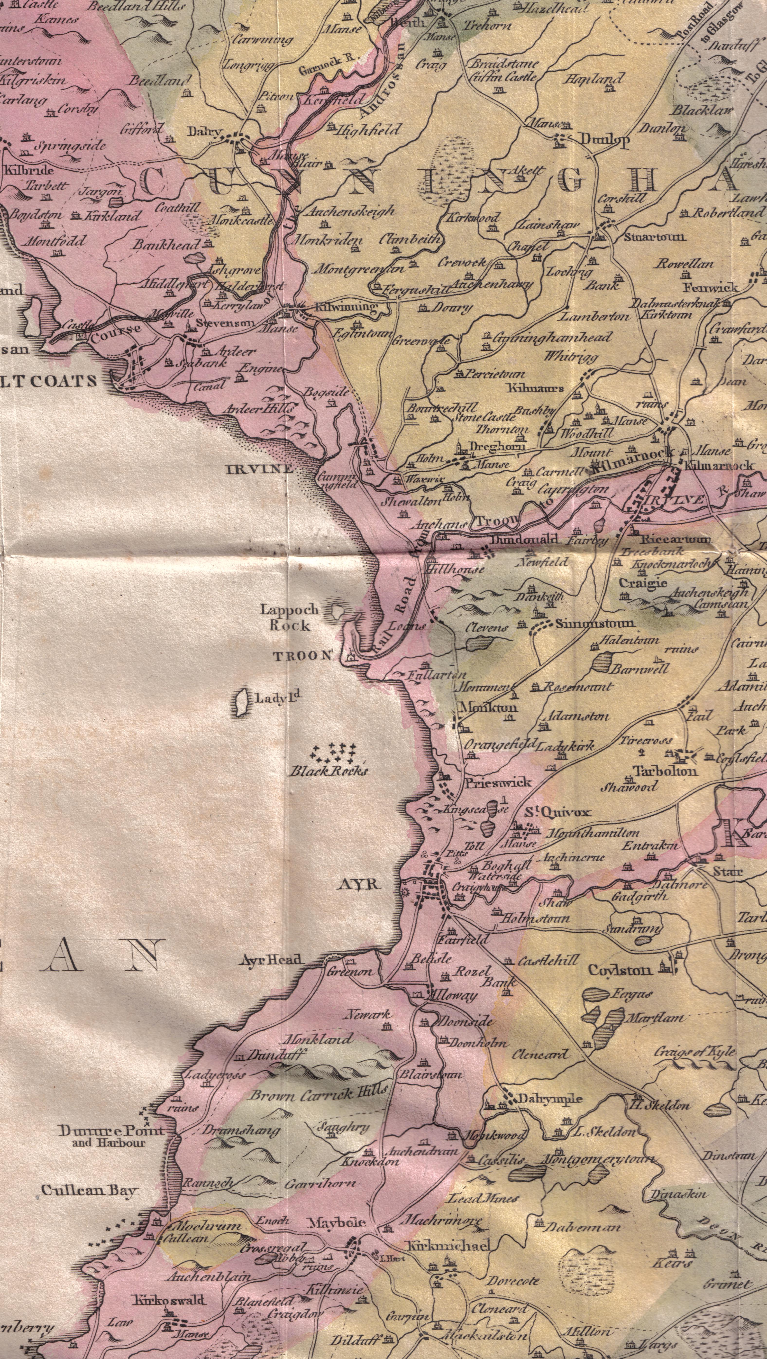
English: A map of Ayrshire showing Dunduff Castle and the roads and trackways. Scotland. |
| Datum | |
| Quelle | William Aiton General View of the Agriculture of the County of Ayr |
| Urheber | Roger Griffith William Aiton |
Lizenz
|
Dieses Werk ist gemeinfrei, weil seine urheberrechtliche Schutzfrist abgelaufen ist. | |
| Es wurde festgestellt, dass diese Datei frei von bekannten Beschränkungen durch das Urheberrecht ist, alle verbundenen und verwandten Rechte eingeschlossen. | |
Dateiversionen
Klicke auf einen Zeitpunkt, um diese Version zu laden.
| Version vom | Vorschaubild | Maße | Benutzer | Kommentar | |
|---|---|---|---|---|---|
| aktuell | 01:38, 4. Mär. 2010 | | 3.152 × 5.584 (3,02 MB) | Rosser1954 | {{Information |Description={{en|1=A map of Ayrshire showing Dunduff Castle and the roads and trackways. Scotland.}} |Source=William Aiton General View of the Agriculture of the County of Ayr |Author=Roger Griffith William Aiton |Date=1811 |Permission= |o |
Dateiverwendung
Die folgenden 7 Seiten verwenden diese Datei:
Globale Dateiverwendung
Die nachfolgenden anderen Wikis verwenden diese Datei:
- Verwendung auf en.wikipedia.org
- Dunure Castle
- Lambroughton
- Barony and Castle of Corsehill
- Eglinton Castle
- Cunninghamhead Estate
- Auchenharvie Castle
- Annick Lodge and Greenville
- Thorntoun house and estate
- Laigh Milton Viaduct
- Rowallan Castle
- Barony and Castle of Giffen
- Kilmaurs Place
- Montgreenan
- Kilmaurs Castle
- Clonbeith Castle
- Busbie Castle
- Giffordland
- Broadstone Castle
- Craigie Castle
- Monkton, South Ayrshire
- Castle and Barony of Robertland
- Dunduff Castle
- Orangefield House, South Ayrshire
- Helenton Loch
- Shaw Monument
- Loch Fergus
- Lands of Tour and Kirkland
- Dalmusternock, East Ayrshire