Datei:Global Vegetation map - GPN-2003-00029.jpg
Größe dieser Vorschau: 750 × 600 Pixel. Weitere Auflösungen: 300 × 240 Pixel | 600 × 480 Pixel | 960 × 768 Pixel | 1.280 × 1.024 Pixel | 2.560 × 2.048 Pixel | 3.000 × 2.400 Pixel
Originaldatei (3.000 × 2.400 Pixel, Dateigröße: 6,92 MB, MIME-Typ: image/jpeg)
![]()
Diese Datei und die Informationen unter dem roten Trennstrich werden aus dem zentralen Medienarchiv Wikimedia Commons eingebunden.
![]()
| Beschreibung |
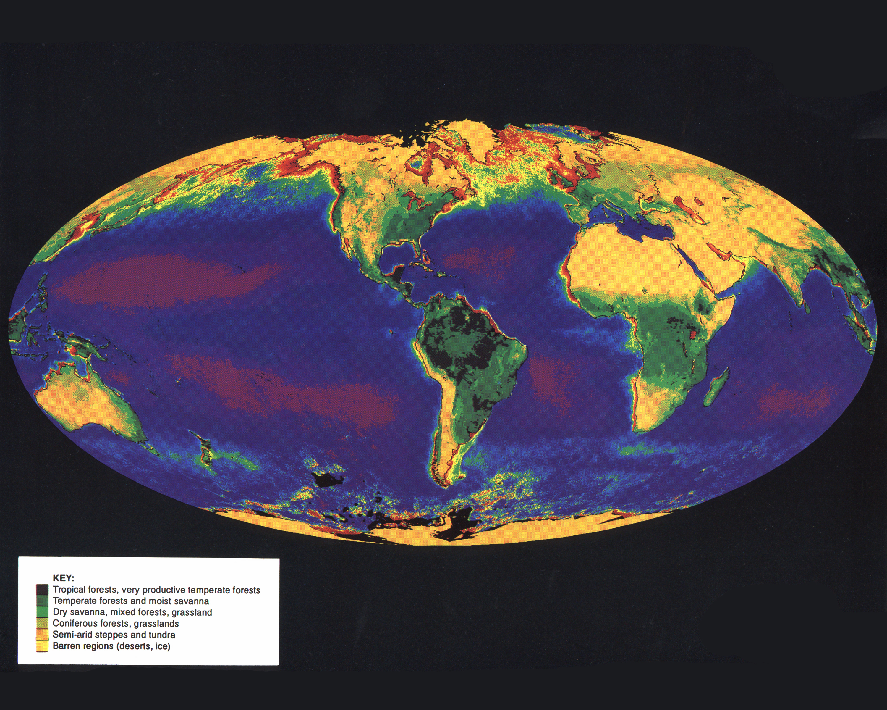
English: This image is comprised of data from the Advanced Very High Resolution Radiometer (AVHRR) aboard the National Oceanic and Atmospheric Administration's (NOAA) Polar Orbiting Environmental Satellite (POES) series to map global vegetation cover. The vegetation covering the continents was recorded by the AVHRR aboard NOAA-7, NOAA-8, and NOAA-11. Dense vegetation is represented by shades of purple and green; sparse vegetation by shades of brown. The vegetation "index," an indicator of vegetation cover, is calculated by comparing reflected infrared light to reflected visible light for a specific area of land. NOAA's two operational polar orbiting satellites scan the entire earth once every six hours from altitudes of about 850km (529 miles). The data collected by the AVHRR sensor are held in the archives of the United States Geological Survey's EROS Data Center. The objective of the AVHRR instrument was to provide radiance data for investigation of clouds, land-water boundaries, snow and ice extent, ice or snow melt inception, day and night cloud distribution, temperatures of radiating surfaces, and sea surface temperature. |
|||||
| Datum | ||||||
| Quelle | Great Images in NASA Description | |||||
| Urheber | NASA | |||||
| Genehmigung (Weiternutzung dieser Datei) |
|

Diese Mediendatei wurde vom NASA-Hauptquartier der US-amerikanischen National Aeronautics and Space Administration (NASA) unter der Datei-ID GPN-2003-00029 UND der Alternativen Datei-ID Global-Biosphere kategorisiert. Diese Markierung zeigt nicht den Urheberrechtsstatus des zugehörigen Werks an. Es ist in jedem Falle zusätzlich eine normale Lizenzvorlage erforderlich. Siehe Commons:Lizenzen für weitere Informationen. Sprachen:
|
Dateiversionen
Klicke auf einen Zeitpunkt, um diese Version zu laden.
| Version vom | Vorschaubild | Maße | Benutzer | Kommentar | |
|---|---|---|---|---|---|
| aktuell | 02:16, 10. Apr. 2009 | | 3.000 × 2.400 (6,92 MB) | BotMultichillT | {{Information |Description={{en|1=This image is comprised of data from the Advanced Very High Resolution Radiometer (AVHRR) aboard the National Oceanic and Atmospheric Administration's (NOAA) Polar Orbiting Environmental Satellite (POES) series to map glo |
Dateiverwendung
Die folgende Seite verwendet diese Datei:
Globale Dateiverwendung
Die nachfolgenden anderen Wikis verwenden diese Datei:
- Verwendung auf kw.wikipedia.org
- Verwendung auf simple.wikipedia.org