Datei:Ghurids1200.png
Größe dieser Vorschau: 800 × 467 Pixel. Weitere Auflösungen: 320 × 187 Pixel | 640 × 373 Pixel | 1.024 × 597 Pixel | 1.644 × 959 Pixel
Originaldatei (1.644 × 959 Pixel, Dateigröße: 28 KB, MIME-Typ: image/png)
![]()
Diese Datei und die Informationen unter dem roten Trennstrich werden aus dem zentralen Medienarchiv Wikimedia Commons eingebunden.
![]()
Beschreibung
| Beschreibung |
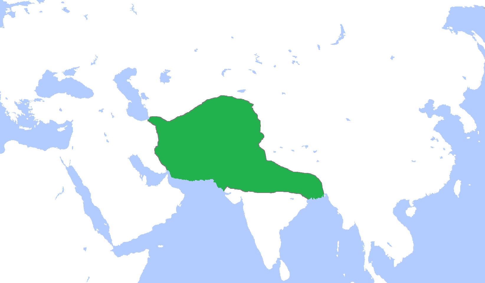
English: Locator map of the Ghurid Empire, c. 1200.
(Partially based on Atlas of World History (2007) - The World 1000-1200, map) |
| Datum | |
| Quelle | Eigenes Werk |
| Urheber | Gabagool |
Lizenz
Ich, der Urheber dieses Werkes, veröffentliche es unter der folgenden Lizenz:
Diese Datei ist unter der Creative-Commons-Lizenz „Namensnennung 3.0 nicht portiert“ lizenziert.
- Dieses Werk darf von dir
- verbreitet werden – vervielfältigt, verbreitet und öffentlich zugänglich gemacht werden
- neu zusammengestellt werden – abgewandelt und bearbeitet werden
- Zu den folgenden Bedingungen:
- Namensnennung – Du musst angemessene Urheber- und Rechteangaben machen, einen Link zur Lizenz beifügen und angeben, ob Änderungen vorgenommen wurden. Diese Angaben dürfen in jeder angemessenen Art und Weise gemacht werden, allerdings nicht so, dass der Eindruck entsteht, der Lizenzgeber unterstütze gerade dich oder deine Nutzung besonders.
Dateiversionen
Klicke auf einen Zeitpunkt, um diese Version zu laden.
| Version vom | Vorschaubild | Maße | Benutzer | Kommentar | |
|---|---|---|---|---|---|
| aktuell | 18:06, 9. Jan. 2014 | | 1.644 × 959 (28 KB) | HistoryofIran | Added the domains of the Bamiyan branch. |
| 17:35, 29. Dez. 2013 |  | 1.644 × 959 (28 KB) | HistoryofIran | Fixed. | |
| 14:00, 29. Dez. 2013 |  | 1.644 × 959 (28 KB) | HistoryofIran | Made the map more accurate. | |
| 14:57, 18. Jun. 2013 |  | 1.644 × 959 (28 KB) | HistoryofIran | ||
| 17:32, 24. Apr. 2009 |  | 1.644 × 959 (53 KB) | Gabagool | {{Information |Description={{en|1=Locator map of the Ghurid Empire, c. 1200. (Partially based on ''Atlas of World History'' (2007) - The World 1000-1200, map)}} |Source=Own work by uploader |Author=Gabagool / Jarle Grøhn |Date=2009-04- |
Dateiverwendung
Die folgende Seite verwendet diese Datei:
Globale Dateiverwendung
Die nachfolgenden anderen Wikis verwenden diese Datei:
- Verwendung auf ar.wikipedia.org
- الدولة الغزنوية
- غوريون
- نيسابور
- غزنة
- باميان
- ولاية غور
- محمد الغوري
- قالب:غوريون
- مستخدم:محمد رشاد ابوالنجا/Spread of Islam
- أبو علي بن محمد
- محمد بن سوري
- أمير سوري
- عباس بن شيت
- محمد بن عباس
- قطب الدين حسن
- عز الدين حسين
- سيف الدين سوري
- بهاء الدين سام الأول
- علاء الدين حسين
- غياث الدين محمد
- بهاء الدين سام الثالث
- غياث الدين محمود
- Verwendung auf arz.wikipedia.org
- Verwendung auf av.wikipedia.org
- Verwendung auf azb.wikipedia.org
- Verwendung auf az.wikipedia.org
- Verwendung auf ba.wikipedia.org
- Verwendung auf bn.wikipedia.org
- Verwendung auf ca.wikipedia.org
- Verwendung auf ceb.wikipedia.org
- Verwendung auf cv.wikipedia.org
- Verwendung auf da.wikipedia.org
- Verwendung auf en.wikipedia.org
Weitere globale Verwendungen dieser Datei anschauen.