Datei:FukushimaMapCurrent.png

Größe dieser Vorschau: 800 × 563 Pixel. Weitere Auflösungen: 320 × 225 Pixel | 640 × 450 Pixel | 1.024 × 720 Pixel | 1.281 × 901 Pixel
Originaldatei (1.281 × 901 Pixel, Dateigröße: 50 KB, MIME-Typ: image/png)
![]()
Diese Datei und die Informationen unter dem roten Trennstrich werden aus dem zentralen Medienarchiv Wikimedia Commons eingebunden.
![]()
Beschreibung
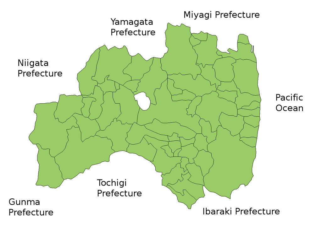
Map of Fukushima Prefecture, Japan.
Thanks to Aoki Shigenobu and [1]. Colors from Image:TokyoMapCurrent.png by User:Fg2.
Lizenz

|
Der Urheberrechtsinhaber erlaubt es jedem, dieses Werk für jeglichen Zweck, inklusive uneingeschränkter Weiterveröffentlichung, kommerziellem Gebrauch und Modifizierung, zu nutzen.
|
Dateiversionen
Klicke auf einen Zeitpunkt, um diese Version zu laden.
| Version vom | Vorschaubild | Maße | Benutzer | Kommentar | |
|---|---|---|---|---|---|
| aktuell | 17:58, 28. Sep. 2011 | | 1.281 × 901 (50 KB) | Haaninjo | The city of Motomiya was created, and Iino merged into Fukushima. |
| 07:31, 19. Jul. 2006 |  | 1.281 × 901 (50 KB) | Akanemoto~commonswiki | Reverted to earlier revision | |
| 14:23, 18. Jul. 2006 |  | 1.050 × 800 (20 KB) | Akanemoto~commonswiki | remove texts | |
| 12:43, 18. Jul. 2006 |  | 1.281 × 901 (50 KB) | Akanemoto~commonswiki | Map of Fukushima Prefecture, Japan. Thanks to Aoki Shigenobu and [http://aoki2.si.gunma-u.ac.jp/map/map.html]. Colors from Image:TokyoMapCurrent.png by User:Fg2. Category:Maps of Fukushima prefecture Category:Maps in English |
Dateiverwendung
Keine Seiten verwenden diese Datei.
Globale Dateiverwendung
Die nachfolgenden anderen Wikis verwenden diese Datei:
- Verwendung auf ast.wikipedia.org
- Verwendung auf az.wikipedia.org
- Verwendung auf ba.wikipedia.org
- Verwendung auf ckb.wikipedia.org
- Verwendung auf cs.wikipedia.org
- Verwendung auf es.wikipedia.org
- Verwendung auf eu.wikipedia.org
- Verwendung auf fa.wikipedia.org
- Verwendung auf gan.wikipedia.org
- Verwendung auf lt.wikipedia.org
- Verwendung auf ms.wikipedia.org
- Verwendung auf no.wikipedia.org
- Verwendung auf pam.wikipedia.org
- Verwendung auf pt.wikipedia.org
- Verwendung auf ru.wikipedia.org
- Verwendung auf su.wikipedia.org
- Verwendung auf vi.wikipedia.org