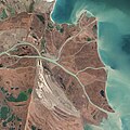
Datei:Danubedelta chilia lobe satellite image.jpg

Größe dieser Vorschau: 600 × 600 Pixel. Weitere Auflösungen: 240 × 240 Pixel | 480 × 480 Pixel | 768 × 768 Pixel | 1.024 × 1.024 Pixel | 2.048 × 2.048 Pixel | 3.679 × 3.679 Pixel
Originaldatei (3.679 × 3.679 Pixel, Dateigröße: 3,95 MB, MIME-Typ: image/jpeg)
Dateiversionen
Klicke auf einen Zeitpunkt, um diese Version zu laden.
| Version vom | Vorschaubild | Maße | Benutzer | Kommentar | |
|---|---|---|---|---|---|
| aktuell | 00:10, 5. Jul. 2014 |  | 3.679 × 3.679 (3,95 MB) | Gretarsson | {{Information |Description ={{en|1=Original image caption (excerpt): The image above was acquired on February 5, 2013, by the Advanced Land Imager (ALI) on NASA’s Earth Observing-1 (EO-1) satellite. The Danube Delta has a number of lobes formed ov... |
Dateiverwendung
Die folgende Seite verwendet diese Datei:
Globale Dateiverwendung
Die nachfolgenden anderen Wikis verwenden diese Datei:
- Verwendung auf cy.wikipedia.org
- Verwendung auf da.wikipedia.org
- Verwendung auf fa.wikipedia.org
- Verwendung auf fi.wikipedia.org
- Verwendung auf ja.wikipedia.org
- Verwendung auf mk.wikipedia.org
- Verwendung auf ru.wikipedia.org
- Verwendung auf sl.wikipedia.org
- Verwendung auf ta.wikipedia.org
- Verwendung auf th.wikipedia.org
- Verwendung auf uk.wikipedia.org
- Verwendung auf vi.wikipedia.org

