Datei:CAK-Diagram.png
Größe dieser Vorschau: 390 × 599 Pixel. Weitere Auflösungen: 156 × 240 Pixel | 312 × 480 Pixel | 774 × 1.189 Pixel
Originaldatei (774 × 1.189 Pixel, Dateigröße: 166 KB, MIME-Typ: image/png)
![]()
Diese Datei und die Informationen unter dem roten Trennstrich werden aus dem zentralen Medienarchiv Wikimedia Commons eingebunden.
![]()
| Beschreibung |
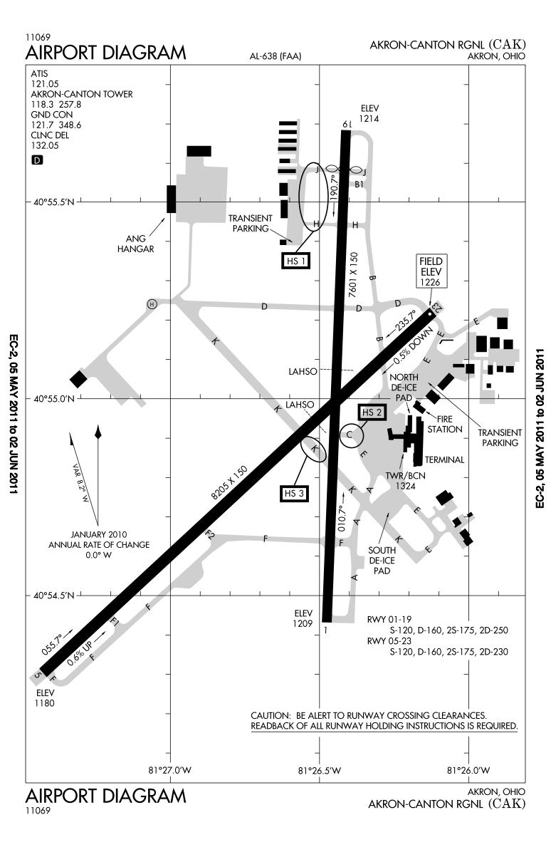
English: Higher resolution of the FAA diagram of en:Akron-Canton Regional Airport (CAK) in Akron, Ohio, converted from PDF format to PNG format by me, User:IanManka. Original PDF file
Note: this URL changes monthly; the airport article should contain a link to the current FAA diagram. Produced by the National Aeronautical Charting Office (NACO), a department of the en:Federal Aviation Administration (FAA). |
|||
| Datum | ||||
| Quelle | http://aeronav.faa.gov/d-tpp/1105/00638AD.PDF | |||
| Urheber | en:Federal Aviation Administration | |||
| Genehmigung (Weiternutzung dieser Datei) |
|
|||
| Andere Versionen | File:CAK-Diagram.gif |

Dateiversionen
Klicke auf einen Zeitpunkt, um diese Version zu laden.
| Version vom | Vorschaubild | Maße | Benutzer | Kommentar | |
|---|---|---|---|---|---|
| aktuell | 07:02, 9. Mai 2011 | | 774 × 1.189 (166 KB) | IanManka | {{Information |Description ={{en|1=Higher resolution of the FAA diagram of en:Akron-Canton Regional Airport (CAK) in Akron, Ohio, converted from PDF format to PNG format by me, User:IanManka. [http://aeronav.faa.gov/d-tpp/1105/00638AD.PDF Orig |
Dateiverwendung
Die folgende Seite verwendet diese Datei:
Globale Dateiverwendung
Die nachfolgenden anderen Wikis verwenden diese Datei:
- Verwendung auf arz.wikipedia.org
- Verwendung auf ceb.wikipedia.org
- Verwendung auf en.wikipedia.org
- Verwendung auf en.wikivoyage.org
- Verwendung auf fa.wikipedia.org
- Verwendung auf fi.wikipedia.org
- Verwendung auf fr.wikipedia.org
- Verwendung auf it.wikivoyage.org
- Verwendung auf ja.wikipedia.org
- Verwendung auf mr.wikipedia.org
- Verwendung auf no.wikipedia.org
- Verwendung auf ro.wikipedia.org
- Verwendung auf tg.wikipedia.org
- Verwendung auf ur.wikipedia.org
- Verwendung auf www.wikidata.org