Datei:Birding Hotspots of the Northern Sacramento Valley (Map).png
.png)
.png&action=edit&redlink=1)
Originaldatei (2.316 × 3.046 Pixel, Dateigröße: 3,76 MB, MIME-Typ: image/png)
![]()
Diese Datei und die Informationen unter dem roten Trennstrich werden aus dem zentralen Medienarchiv Wikimedia Commons eingebunden.
![]()
.png?uselang=de)
Beschreibung
| Beschreibung |
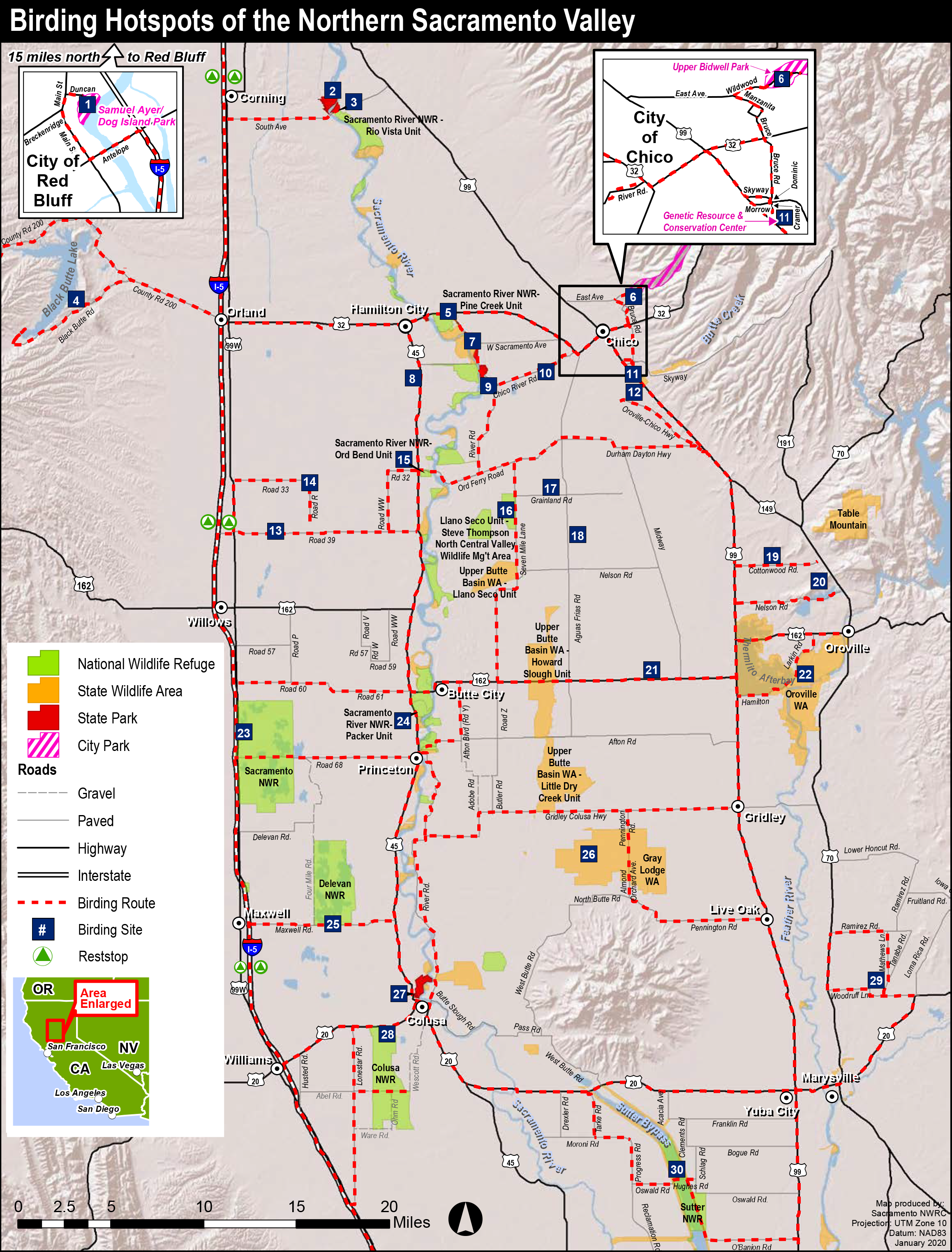
English: Birding Hotspots of the Northern Sacramento Valley, via Sacramento National Wildlife Refuge – Additional maps. 1: City of Red Bluff – Samuel Ayer / Dog Island Park |
| Datum | [2012] |
| Quelle | https://www.fws.gov/uploadedFiles/Region_8/NWRS/Zone_1/Sacramento_Complex/Sacramento/Uploaded_Files/Maps_and_Brochures/Visitor_Services/Birding_Maps/SacValley%20Birding%20Map%202012.pdf |
| Urheber | U.S. Fish & Wildlife Service |
Lizenz
Diese Datei ist ein Werk eines Mitarbeiters des United States Fish and Wildlife Service, aufgenommen oder hergestellt während seiner offiziellen Anstellung. Als amtliches Werk der Bundesregierung der Vereinigten Staaten ist dieses Bild gemeinfrei. Für weitere Informationen, siehe die Urheberrechtsbestimmungen des Fish and Wildlife Service.
|
 |
Dateiversionen
Klicke auf einen Zeitpunkt, um diese Version zu laden.
| Version vom | Vorschaubild | Maße | Benutzer | Kommentar | |
|---|---|---|---|---|---|
| aktuell | 01:16, 26. Sep. 2021 | | 2.316 × 3.046 (3,76 MB) | Frank Schulenburg | Uploaded a work by U.S. Fish & Wildlife Service from https://www.fws.gov/uploadedFiles/Region_8/NWRS/Zone_1/Sacramento_Complex/Sacramento/Uploaded_Files/Maps_and_Brochures/Visitor_Services/Birding_Maps/SacValley%20Birding%20Map%202012.pdf with UploadWizard |
Dateiverwendung
Die folgende Seite verwendet diese Datei:
.png)