Datei:WalkerExpeditionMarker.jpg
Größe dieser Vorschau: 800 × 424 Pixel. Weitere Auflösungen: 320 × 170 Pixel | 640 × 340 Pixel | 1.024 × 543 Pixel | 1.280 × 679 Pixel | 1.960 × 1.040 Pixel
Originaldatei (1.960 × 1.040 Pixel, Dateigröße: 598 KB, MIME-Typ: image/jpeg)
![]()
Diese Datei und die Informationen unter dem roten Trennstrich werden aus dem zentralen Medienarchiv Wikimedia Commons eingebunden.
![]()
Beschreibung
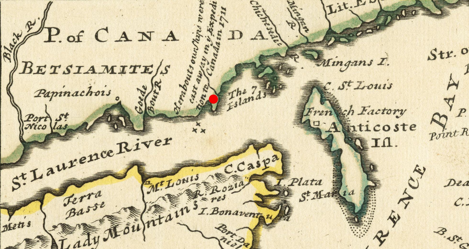
| Beschreibung | A period map marked with the site of the 1711 Quebec Expedition naval disaster. | |||||||||||||||||||||||
| Datum | ||||||||||||||||||||||||
| Quelle |
From the Boston Public Library digital map collection: http://maps.bpl.org/details_14080/ Call Number: G3400 1732 .M65 |
|||||||||||||||||||||||
| Urheber |
|
|||||||||||||||||||||||

Lizenz
|
Dies ist eine originalgetreue fotografische Reproduktion eines zweidimensionalen Kunstwerks. Das Kunstwerk an sich ist aus dem folgenden Grund gemeinfrei:
Nach offizieller Ansicht der Wikimedia Foundation sind originalgetreue Reproduktionen zweidimensionaler gemeinfreier Werke gemeinfrei. Diese fotografische Reproduktion wird daher auch als gemeinfrei in den Vereinigten Staaten angesehen. Die Verwendung dieser Werke kann in anderen Rechtssystemen verboten oder nur eingeschränkt erlaubt sein. Zu Details siehe Reuse of PD-Art photographs.
| ||||
Dateiversionen
Klicke auf einen Zeitpunkt, um diese Version zu laden.
| Version vom | Vorschaubild | Maße | Benutzer | Kommentar | |
|---|---|---|---|---|---|
| aktuell | 18:29, 7. Jan. 2011 | | 1.960 × 1.040 (598 KB) | Magicpiano | {{Information |Description=A period map marked with the site of the 1711 w:Quebec Expedition naval disaster. |Source=From the Boston Public Library digital map collection: http://maps.bpl.org/details_14080/ Call Number: G3400 1732 .M65 |Date=1733 |Au |
Dateiverwendung
Die folgende Seite verwendet diese Datei:
Globale Dateiverwendung
Die nachfolgenden anderen Wikis verwenden diese Datei:
- Verwendung auf en.wikipedia.org
- Verwendung auf es.wikipedia.org
- Verwendung auf fr.wikipedia.org
- Verwendung auf it.wikipedia.org
- Verwendung auf ja.wikipedia.org
- Verwendung auf nn.wikipedia.org
- Verwendung auf no.wikipedia.org
- Verwendung auf sv.wikipedia.org