Datei:USACE Lavon Lake and Dam.jpg
Größe dieser Vorschau: 752 × 600 Pixel. Weitere Auflösungen: 301 × 240 Pixel | 602 × 480 Pixel | 987 × 787 Pixel
Originaldatei (987 × 787 Pixel, Dateigröße: 200 KB, MIME-Typ: image/jpeg)
![]()
Diese Datei und die Informationen unter dem roten Trennstrich werden aus dem zentralen Medienarchiv Wikimedia Commons eingebunden.
![]()
| Beschreibung |
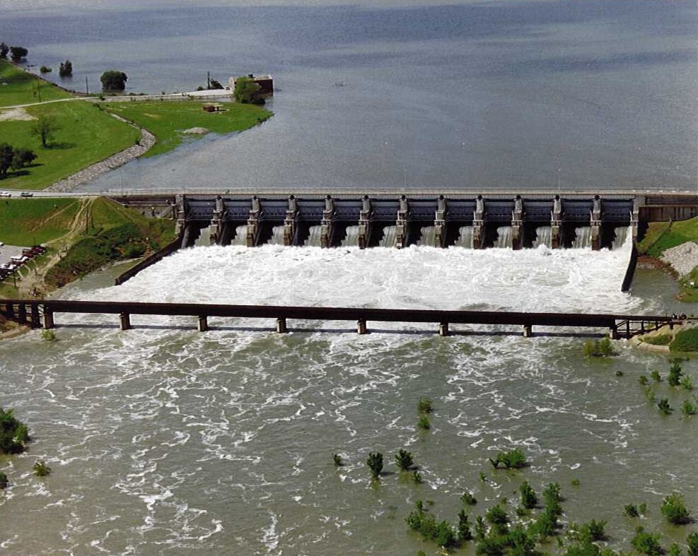
English: Aerial view of Lavon Dam and Lake on the East Fork of the Trinity River in Collin County, Texas, USA. The dam was constructed in 1953 by the U.S. Army Corps of Engineers for flood control and water supply. View is to the north
Coordinates: 33°02′40″N 96°27′56″W / 33.0444°N 96.46556°W |
|||
| Ort | Collin County, Texas, USA | |||
| Datum | not specified or unknown | |||
| Quelle |
U.S. Army Corps of Engineers Lavon Lake website Image page Image description page |
|||
| Urheber | U.S. Army Corps of Engineers, photographer not specified or unknown | |||
| Genehmigung (Weiternutzung dieser Datei) |
|
Dateiversionen
Klicke auf einen Zeitpunkt, um diese Version zu laden.
| Version vom | Vorschaubild | Maße | Benutzer | Kommentar | |
|---|---|---|---|---|---|
| aktuell | 06:33, 9. Mai 2007 | | 987 × 787 (200 KB) | DanMS | Trimmed excess white space around image and uploaded same again. |
| 06:31, 9. Mai 2007 |  | 1.002 × 800 (100 KB) | DanMS | {{Information | Description = {{en|Aerial view of Lavon Dam and Lake on the East Fork of the Trinity River in Collin County, Texas, USA. The dam was constructed in 1953 by the U.S. Army Corps of Engineers for flood control and water supply. View is to |
Dateiverwendung
Die folgende Seite verwendet diese Datei:
Globale Dateiverwendung
Die nachfolgenden anderen Wikis verwenden diese Datei:
- Verwendung auf arz.wikipedia.org
- Verwendung auf ceb.wikipedia.org
- Verwendung auf en.wikipedia.org
- Verwendung auf la.wikipedia.org
- Verwendung auf www.wikidata.org