Datei:Stroma OS map.png
Größe dieser Vorschau: 454 × 599 Pixel. Weitere Auflösungen: 182 × 240 Pixel | 363 × 480 Pixel | 582 × 768 Pixel | 1.174 × 1.550 Pixel
Originaldatei (1.174 × 1.550 Pixel, Dateigröße: 151 KB, MIME-Typ: image/png)
![]()
Diese Datei und die Informationen unter dem roten Trennstrich werden aus dem zentralen Medienarchiv Wikimedia Commons eingebunden.
![]()
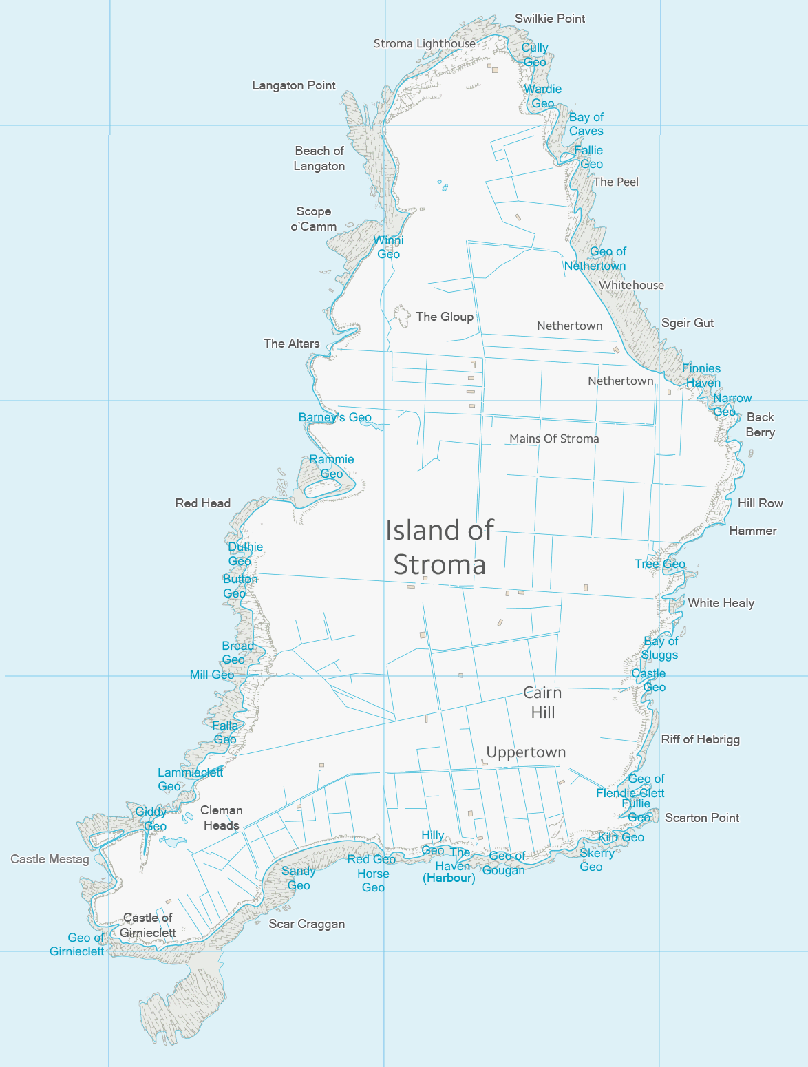
| Beschreibung | Map of Stroma, Scotland | ||||||
| Datum | |||||||
| Quelle | Ordnance Survey OpenData with additional placenames added by uploader | ||||||
| Urheber | Ordnance Survey | ||||||
| Genehmigung (Weiternutzung dieser Datei) |
|
_(St_Edwards_Crown).svg)

|
Dieses Bild des Typs Map sollte als Vektorgrafik im SVG-Format neu erstellt werden. Vektorformate haben zahlreiche Vorteile; weitere Information unter Commons:Media for cleanup. Wenn dir eine SVG-Version dieses Bildes vorliegt, so lade diese bitte hoch. Nach dem Hochladen der Datei ist diese Vorlage auf der aktuellen Bildbeschreibungsseite durch die Vorlage {{Vector version available}}, oder kürzer {{Vva}}, zu ersetzen. Es ist empfohlen die neue SVG-Datei „Stroma OS map.svg“ zu nennen – dann benötigt die Vorlage vector version available (bzw. vva) keinen Parameter.
|
Dateiversionen
Klicke auf einen Zeitpunkt, um diese Version zu laden.
| Version vom | Vorschaubild | Maße | Benutzer | Kommentar | |
|---|---|---|---|---|---|
| aktuell | 02:02, 31. Okt. 2013 | | 1.174 × 1.550 (151 KB) | Prioryman | |
| 02:01, 31. Okt. 2013 |  | 1.174 × 1.550 (151 KB) | Prioryman | {{Information |Description=Map of Stroma, Scotland |Source=Ordnance Survey OpenData with additions by uploader |Date=31 October 2013 |Author=Ordnance Survey |Permission={{OS OpenData}} |other_versions= }} Category:Stroma |
Dateiverwendung
Die folgenden 2 Seiten verwenden diese Datei:
Globale Dateiverwendung
Die nachfolgenden anderen Wikis verwenden diese Datei:
- Verwendung auf en.wikipedia.org
- Verwendung auf it.wikipedia.org
- Verwendung auf simple.wikipedia.org