Datei:Sandusky Ohio aerial view.jpg
Größe dieser Vorschau: 800 × 533 Pixel. Weitere Auflösungen: 320 × 213 Pixel | 640 × 426 Pixel | 1.024 × 682 Pixel | 1.500 × 999 Pixel
Originaldatei (1.500 × 999 Pixel, Dateigröße: 761 KB, MIME-Typ: image/jpeg)
![]()
Diese Datei und die Informationen unter dem roten Trennstrich werden aus dem zentralen Medienarchiv Wikimedia Commons eingebunden.
![]()
| Beschreibung |
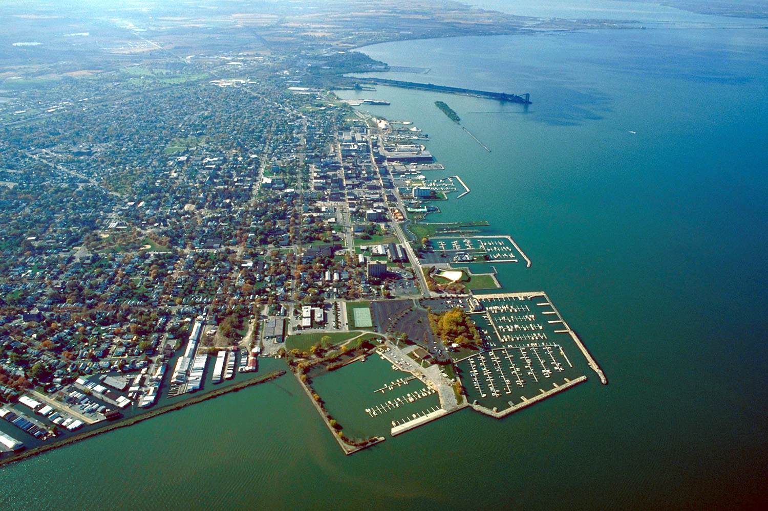
English: Aerial view of Sandusky, Ohio, USA. The view is to the west-southwest along the waterfront on Sandusky Bay, a large inlet and bay off of Lake Erie. |
|||
| Datum | ||||
| Quelle |
U.S. Army Corps of Engineers Digital Visual Library Image page Image description page Digital Visual Library home page |
|||
| Urheber | Ken Winters, U.S. Army Corps of Engineers | |||
| Genehmigung (Weiternutzung dieser Datei) |
|
|||
| Ort | Sandusky, Ohio, USA |
| Kameraposition | | Dieses und weitere Bilder auf OpenStreetMap |
|---|
Dateiversionen
Klicke auf einen Zeitpunkt, um diese Version zu laden.
| Version vom | Vorschaubild | Maße | Benutzer | Kommentar | |
|---|---|---|---|---|---|
| aktuell | 23:44, 24. Mär. 2007 | | 1.500 × 999 (761 KB) | DanMS | {{Information | Description = {{en|Aerial view of Sandusky, Ohio, USA. The view is to the west-southwest along the waterfront on Sandusky Bay, a large inlet and bay off of Lake Erie.}} | Source = U.S. Army Corps of Engineers Digital Visual Libr |
Dateiverwendung
Die folgende Seite verwendet diese Datei:
Globale Dateiverwendung
Die nachfolgenden anderen Wikis verwenden diese Datei:
- Verwendung auf azb.wikipedia.org
- Verwendung auf ceb.wikipedia.org
- Verwendung auf en.wikinews.org
- Verwendung auf es.wikipedia.org
- Verwendung auf fa.wikipedia.org
- Verwendung auf fi.wikipedia.org
- Verwendung auf fr.wikipedia.org
- Verwendung auf it.wikipedia.org
- Verwendung auf ko.wikipedia.org
- Verwendung auf pl.wikipedia.org
- Verwendung auf pt.wikipedia.org
- Verwendung auf ru.wikipedia.org
- Verwendung auf sh.wikipedia.org
- Verwendung auf simple.wikipedia.org
- Verwendung auf sr.wikipedia.org
- Verwendung auf sv.wikipedia.org
- Verwendung auf szl.wikipedia.org
- Verwendung auf tr.wikipedia.org
- Verwendung auf uk.wikipedia.org
- Verwendung auf uz.wikipedia.org
- Verwendung auf zh-min-nan.wikipedia.org
- Verwendung auf zh.wikipedia.org