Datei:Fargo, North Dakota Red River.jpg
Größe dieser Vorschau: 800 × 536 Pixel. Weitere Auflösungen: 320 × 214 Pixel | 640 × 428 Pixel | 1.024 × 685 Pixel | 1.280 × 857 Pixel | 2.560 × 1.714 Pixel | 3.872 × 2.592 Pixel
Originaldatei (3.872 × 2.592 Pixel, Dateigröße: 3,89 MB, MIME-Typ: image/jpeg)
![]()
Diese Datei und die Informationen unter dem roten Trennstrich werden aus dem zentralen Medienarchiv Wikimedia Commons eingebunden.
![]()
Beschreibung
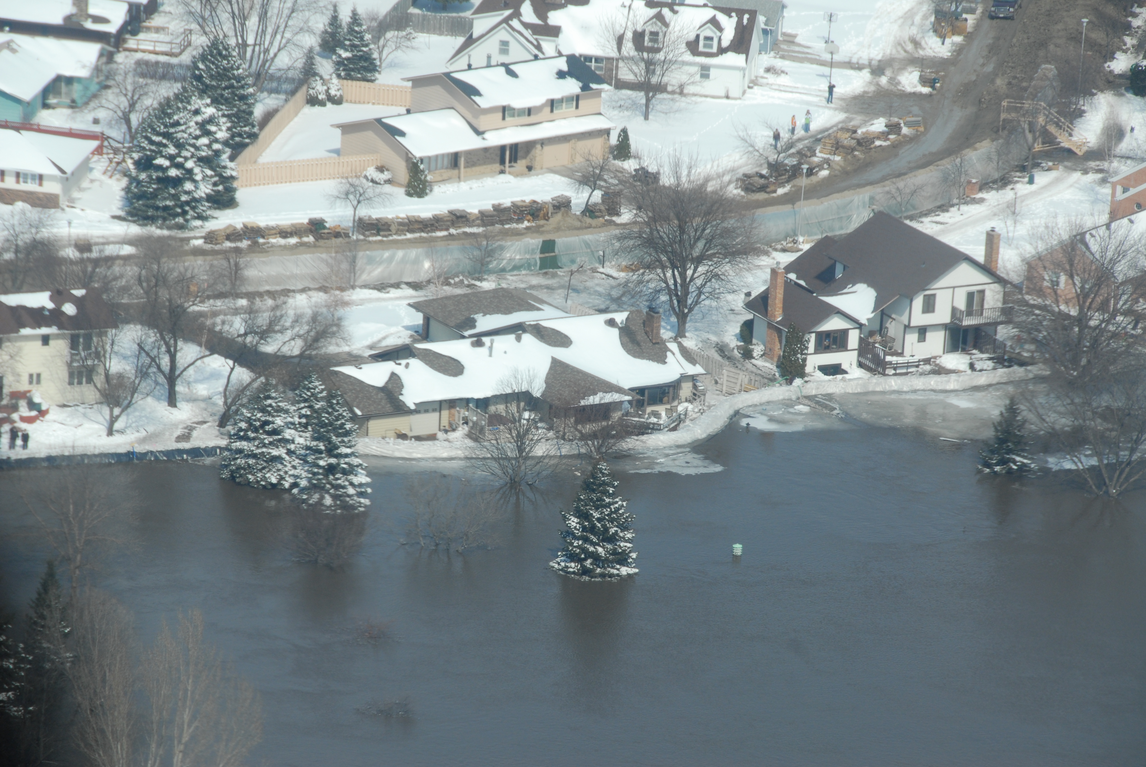
| Beschreibung | An aerial view of rising waters of the Red River from east to west is shown in south Fargo, N.D., March 28, 2009. A sandbag dike lines the river as well as a contingency dike created to block the advancement of water in the event of a dike failure. The rising flood waters of the Red River on the North Dakota and Minnesota border are at the highest level ever recorded in the Fargo and Moorhead, Minn., area. USNORTHCOM is coordinating DoD support to civil authorities conducting disaster relief efforts in Minnesota and North Dakota as ordered by the President or the Secretary of Defense. |
| Datum | |
| Quelle | http://www.northcom.mil/Images/Images_2009/090328-F-0681L-154.jpg |
| Urheber | Photo by Senior Master Sgt. David H. Lipp |
Lizenz
Dieses Werk ist in den Vereinigten Staaten gemeinfrei, da es von Mitarbeitern der US-amerikanischen Bundesregierung oder einem ihrer Organe in Ausübung ihrer dienstlichen Pflichten erstellt wurde und deshalb nach Titel 17, Kapitel 1, Sektion 105 des US Code ein Werk der Regierung der Vereinigten Staaten von Amerika ist.
Achtung: Dies bezieht sich nur auf originale Werke der Bundesregierung oder eines ihrer Organe, jedoch nicht auf Werke der Regierung eines Bundesstaates oder einer lokalen Behörde. Ebenfalls ausgeschlossen sind seit 1978 herausgegebene Briefmarken und bestimmte Geldmünzen.
|
 | |
| Es wurde festgestellt, dass diese Datei frei von bekannten Beschränkungen durch das Urheberrecht ist, alle verbundenen und verwandten Rechte eingeschlossen. | ||
Dateiversionen
Klicke auf einen Zeitpunkt, um diese Version zu laden.
| Version vom | Vorschaubild | Maße | Benutzer | Kommentar | |
|---|---|---|---|---|---|
| aktuell | 23:58, 9. Jan. 2010 | | 3.872 × 2.592 (3,89 MB) | Wikifreund | {{Information |Description=An aerial view of rising waters of the Red River from east to west is shown in south Fargo, N.D., March 28, 2009. A sandbag dike lines the river as well as a contingency dike created to block the advancement of water in the even |
Dateiverwendung
Die folgende Seite verwendet diese Datei: