Originaldatei(SVG-Datei, Basisgröße: 988 × 1.318 Pixel, Dateigröße: 1.009 KB)

Diese Datei und die Informationen unter dem roten Trennstrich werden aus dem zentralen Medienarchiv Wikimedia Commons eingebunden.

Zur Beschreibungsseite auf Commons


Beschreibung

Beschreibung
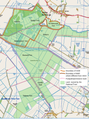
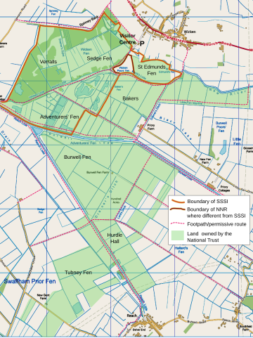
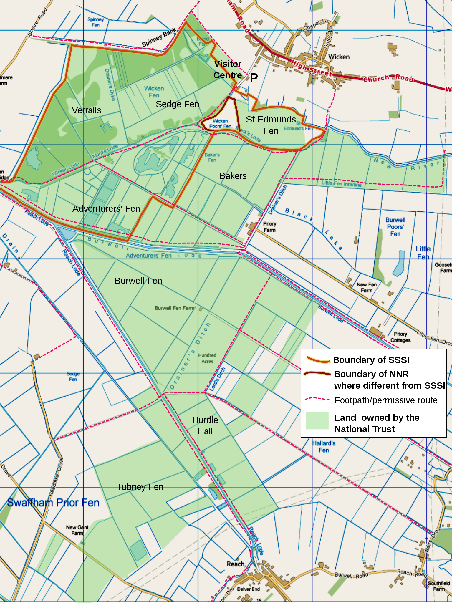
English: map of Wicken Fen National Trust land holdings, Cambridgeshire, UK, using the following for additional information shown:
  •  
    Motorways
  •  
    Primary routes
  •  
    Non-primary A roads
  •  
    B roads
  •  
    Minor roads
  •  
    Railways
  •  
    Water
  •  
    Woodland
  •  
    Buildings

OS map projection (nb: Not WGS 84 datum) with OS 1km grid squares shown. SW origin is TL543660 Geographic limits:

  • W: 0.2613
  • E: 0.3172
  • N: 52.3180
  • S: 52.2698
Datum
Quelle

Ordnance Survey OpenData viewer.

Urheber User:RobinLeicester created using Ordnance Survey data
Genehmigung
(Weiternutzung dieser Datei)
Diese Datei ist von der Ordnance Survey des Vereinigten Königreichs unter deren OS OpenData License
lizenziert. Kurz gesagt: Du kannst die Datei verbreiten und ändern, solange man sie der Ordnance Survey zuordnet (einschließlich Jahr).
Namensnennung: Contains Ordnance Survey data © Crown copyright and database right (year)
Hinweis: Abgeleitete Werke können unter jeder Creative Commons Attribution 3.0-Lizenz lizenziert werden.
This file is licensed under the United Kingdom Open Government Licence v3.0.
You are free to:
  • copy, publish, distribute and transmit the Information;
  • adapt the Information;
  • exploit the Information commercially and non-commercially for example, by combining it with other Information, or by including it in your own product or application.
You must, where you do any of the above:
  • acknowledge the source of the Information in your product or application by including or linking to any attribution statement specified by the Information Provider(s) and, where possible, provide a link to this licence;
  • If the Information Provider does not provide a specific attribution statement, you must use the following:
Contains public sector information licensed under the Open Government Licence v3.0.
This licence does NOT cover:
  • personal data in the Information;
  • Information that has not been accessed by way of publication or disclosure under information access legislation (including the Freedom of Information Acts for the UK and Scotland) by or with the consent of the Information Provider;
  • departmental or public sector organisation logos, crests and the Royal Arms except where they form an integral part of a document or dataset;
  • military insignia;
  • third party rights the Information Provider is not authorised to license;
  • other intellectual property rights, including patents, trade marks, and design rights; and
  • identity documents such as the British Passport.
Consult this guide for full details.
Note: Since 2010, almost all information owned by the UK Crown is offered for use and re-use under the Open Government Licence by authority of The Controller of His Majesty's Stationery Office.info
See also: Meta for information on usage on Wikimedia wikis.

Assembled from 1km squares generated by OS OpenData Viewer at scale '4-from-top'. Edited using a combination of Inkscape and Gimp. Colours shifted to get close to Nilfanion's standard (eg Waltham Forest). My Method: Gimp [Color] [Levels...] 'Input Levels' min=195, max=253. The resulting png imported into Inkscape, for additional text, boundary lines, etc.

Geographic limits can be discovered using this locator page

Lizenz

© Der Urheber gestattet jedermann jede Form der Nutzung, unter der Bedingung der angemessenen Nennung seiner Urheberschaft.

Weiterverbreitung, Bearbeitung und kommerzielle Nutzung sind gestattet.

Kurzbeschreibungen

Ergänze eine einzeilige Erklärung, was diese Datei darstellt.

In dieser Datei abgebildete Objekte

Motiv

Dateiversionen

Klicke auf einen Zeitpunkt, um diese Version zu laden.

Version vomVorschaubildMaßeBenutzerKommentar
aktuell02:52, 16. Dez. 2011Vorschaubild der Version vom 02:52, 16. Dez. 2011988 × 1.318 (1.009 KB)RobinLeicester{{Information |Description ={{en|1=map of Wicken Fen National Trust land holdings, Cambridgeshire, UK, using the following for additional information shown: *{{legend|#667fff|Motorways}} *{{legend|#4cb336|Primary routes}} *{{legend|#fc744c|Non-primary

Die folgende Seite verwendet diese Datei:

Globale Dateiverwendung

Die nachfolgenden anderen Wikis verwenden diese Datei: