Datei:Trinity crater.jpg
Größe dieser Vorschau: 754 × 599 Pixel. Weitere Auflösungen: 302 × 240 Pixel | 604 × 480 Pixel | 966 × 768 Pixel | 1.280 × 1.017 Pixel | 2.560 × 2.035 Pixel | 7.880 × 6.263 Pixel
Originaldatei (7.880 × 6.263 Pixel, Dateigröße: 6,33 MB, MIME-Typ: image/jpeg)
![]()
Diese Datei und die Informationen unter dem roten Trennstrich werden aus dem zentralen Medienarchiv Wikimedia Commons eingebunden.
![]()
| Beschreibung |
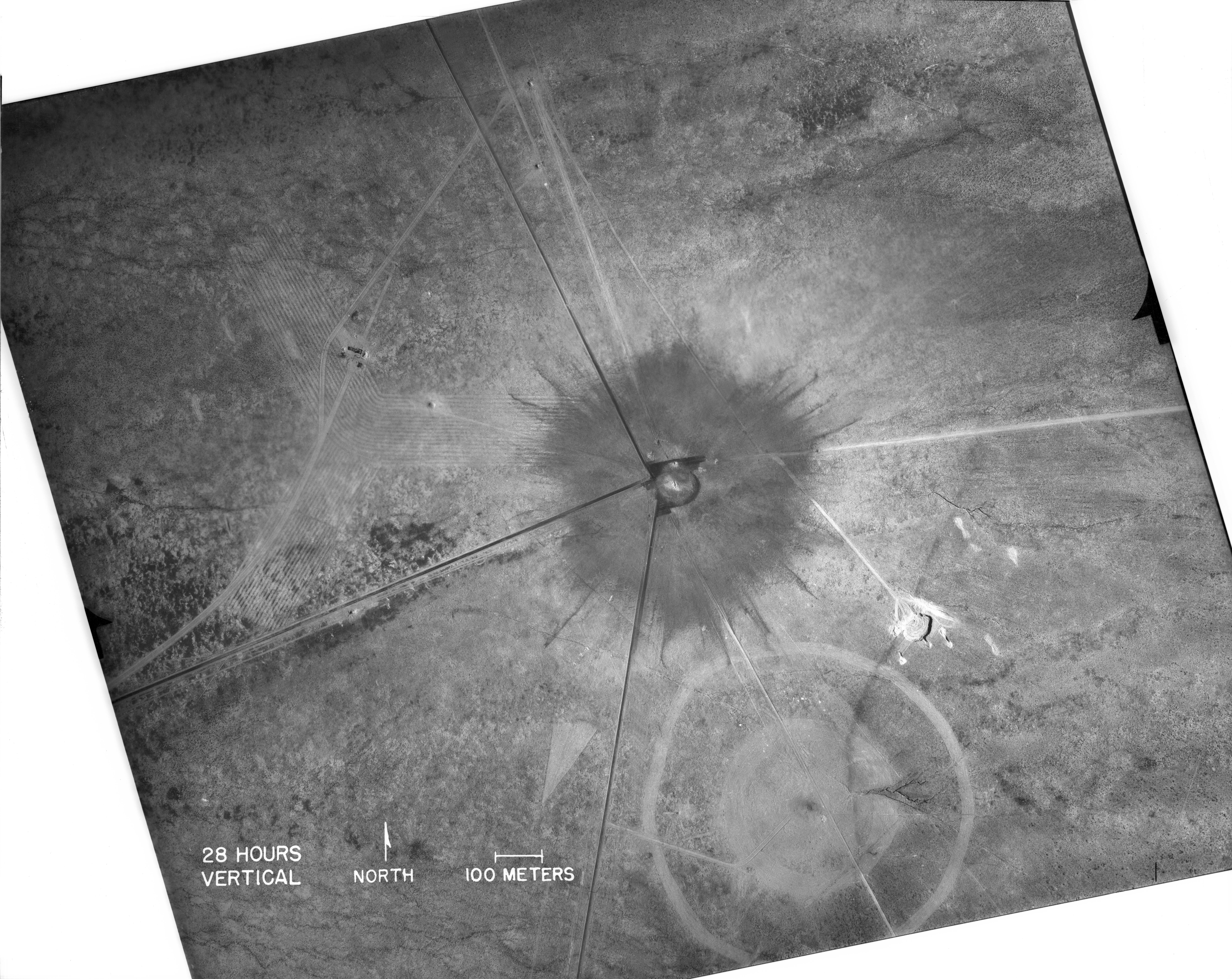
English: White Sands, New Mexico. Aerial view of the aftermath of the Trinity test, 28 hours after the explosion. The smaller crater to the southeast is from the earlier detonation of 100 tons of TNT on May 7, 1945. The dark straight lines are roads. To the left of the crater can be seen the "Jumbo" container, unharmed, and its collapsed tower (a vertical line). |
|
| Datum | ||
| Quelle |
|
|
| Urheber | Federal government of the United States | |
| Andere Versionen |
|
.jpg)
_2.jpg)
| This image is a work of a United States Department of Energy (or predecessor organization) employee, taken or made as part of that person's official duties. As a work of the U.S. federal government, the image is in the public domain.
Please note that national laboratories operate under varying licences and some are not free. Check the site policies of any national lab before crediting it with this tag.
|

|
Dateiversionen
Klicke auf einen Zeitpunkt, um diese Version zu laden.
| Version vom | Vorschaubild | Maße | Benutzer | Kommentar | |
|---|---|---|---|---|---|
| aktuell | 18:03, 1. Okt. 2016 | | 7.880 × 6.263 (6,33 MB) | Quibik | Higher-res from https://www.flickr.com/photos/losalamosnatlab/19282799141/in/album-72157652920995393/ |
| 20:52, 2. Dez. 2005 |  | 800 × 685 (190 KB) | Fastfission~commonswiki | better version | |
| 20:45, 1. Sep. 2005 |  | 472 × 315 (50 KB) | Fastfission~commonswiki | From en: Aerial view of the aftermath of the Trinity test. The smaller crater to the southeast is from the earlier detonation of 100 tons of TNT. Not sure about the scale but those dark straight lines are probably roads. Created as part of the [[Man |
Dateiverwendung
Keine Seiten verwenden diese Datei.
Globale Dateiverwendung
Die nachfolgenden anderen Wikis verwenden diese Datei:
- Verwendung auf cs.wikipedia.org
- Verwendung auf da.wikipedia.org
- Verwendung auf fi.wikipedia.org
- Verwendung auf ja.wikipedia.org
- Verwendung auf pt.wikipedia.org
- Verwendung auf ru.wikipedia.org
- Verwendung auf sr.wikipedia.org
- Verwendung auf www.wikidata.org