Datei:IssaouaneErg Algeria ISS010-E-13539.jpg
Originaldatei (1.000 × 662 Pixel, Dateigröße: 491 KB, MIME-Typ: image/jpeg)
![]()
Diese Datei und die Informationen unter dem roten Trennstrich werden aus dem zentralen Medienarchiv Wikimedia Commons eingebunden.
![]()
Beschreibung
| Beschreibung |
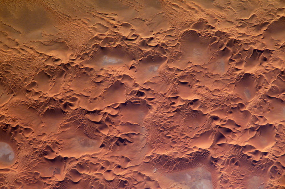
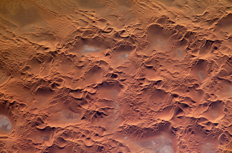
English: Astronaut photo of the Issaouane Erg (Sahara Desert), Algeria.
|
||||||||||||||||||||||||||||||||||||||||||||||||||||||
| Datum | |||||||||||||||||||||||||||||||||||||||||||||||||||||||
| Quelle | http://earthobservatory.nasa.gov/Newsroom/NewImages/images.php3?img_id=16813 | ||||||||||||||||||||||||||||||||||||||||||||||||||||||
| Urheber | ISS Crew Earth Observations experiment and the Image Science & Analysis Group, Johnson Space Center. | ||||||||||||||||||||||||||||||||||||||||||||||||||||||
| Genehmigung (Weiternutzung dieser Datei) |
NASA, public domain | ||||||||||||||||||||||||||||||||||||||||||||||||||||||
Lizenz
Diese Datei ist gemeinfrei (public domain), da sie vom Image Science & Analysis Laboratory der NASA erstellt worden ist. Die NASA-Urheberrechtsrichtlinie besagt, dass „NASA-Material nicht durch Urheberrecht geschützt ist, wenn es nicht anders angegeben ist“ (NASA-Urheberrechtsrichtlinien-Seite oder Nutzungsbedingungen für Fotos von Astronauten). Die Aufnahme ist Teil der Reihe The Gateway to Astronaut Photography of Earth. Bildquelle: ISS010-E-13539.
|
Dateiversionen
Klicke auf einen Zeitpunkt, um diese Version zu laden.
| Version vom | Vorschaubild | Maße | Benutzer | Kommentar | |
|---|---|---|---|---|---|
| aktuell | 19:58, 18. Mai 2006 | | 1.000 × 662 (491 KB) | Holly Cheng | ==Summary== {{Information | Description=Astronaut photo of the Issaouane Erg (Sahara Desert), Algeria. | Source=http://earthobservatory.nasa.gov/Newsroom/NewImages/images.php3?img_id=16813 | Date=January 16, 2005 | Author=ISS Crew Earth Observations exper |
Dateiverwendung
Die folgende Seite verwendet diese Datei:
Globale Dateiverwendung
Die nachfolgenden anderen Wikis verwenden diese Datei:
- Verwendung auf ar.wikipedia.org
- Verwendung auf ba.wikipedia.org
- Verwendung auf be.wikipedia.org
- Verwendung auf bg.wikipedia.org
- Verwendung auf br.wikipedia.org
- Verwendung auf ceb.wikipedia.org
- Verwendung auf da.wikipedia.org
- Verwendung auf en.wikipedia.org
- Verwendung auf eo.wikipedia.org
- Verwendung auf fi.wikipedia.org
- Verwendung auf fr.wikipedia.org
- Verwendung auf fr.wiktionary.org
- Verwendung auf hi.wikipedia.org
- Verwendung auf it.wikipedia.org
- Verwendung auf it.wikibooks.org
- Verwendung auf ka.wikipedia.org
- Verwendung auf lt.wikipedia.org
- Verwendung auf mhr.wikipedia.org
- Verwendung auf mk.wikipedia.org
- Verwendung auf nn.wikipedia.org
- Verwendung auf pl.wikipedia.org
- Verwendung auf pl.wiktionary.org
- Verwendung auf ro.wikipedia.org
- Verwendung auf ru.wikipedia.org
- Verwendung auf sl.wikipedia.org
- Verwendung auf sr.wikipedia.org
- Verwendung auf sv.wikipedia.org
- Verwendung auf sv.wiktionary.org
- Verwendung auf uk.wikipedia.org
- Verwendung auf uz.wikipedia.org
- Verwendung auf vi.wikipedia.org
- Verwendung auf www.wikidata.org