Datei:Cornish windsor bridge.jpg
Größe dieser Vorschau: 800 × 560 Pixel. Weitere Auflösungen: 320 × 224 Pixel | 640 × 448 Pixel | 1.024 × 717 Pixel | 1.280 × 896 Pixel | 2.560 × 1.793 Pixel | 4.567 × 3.198 Pixel
Originaldatei (4.567 × 3.198 Pixel, Dateigröße: 1,49 MB, MIME-Typ: image/jpeg)
![]()
Diese Datei und die Informationen unter dem roten Trennstrich werden aus dem zentralen Medienarchiv Wikimedia Commons eingebunden.
![]()
|
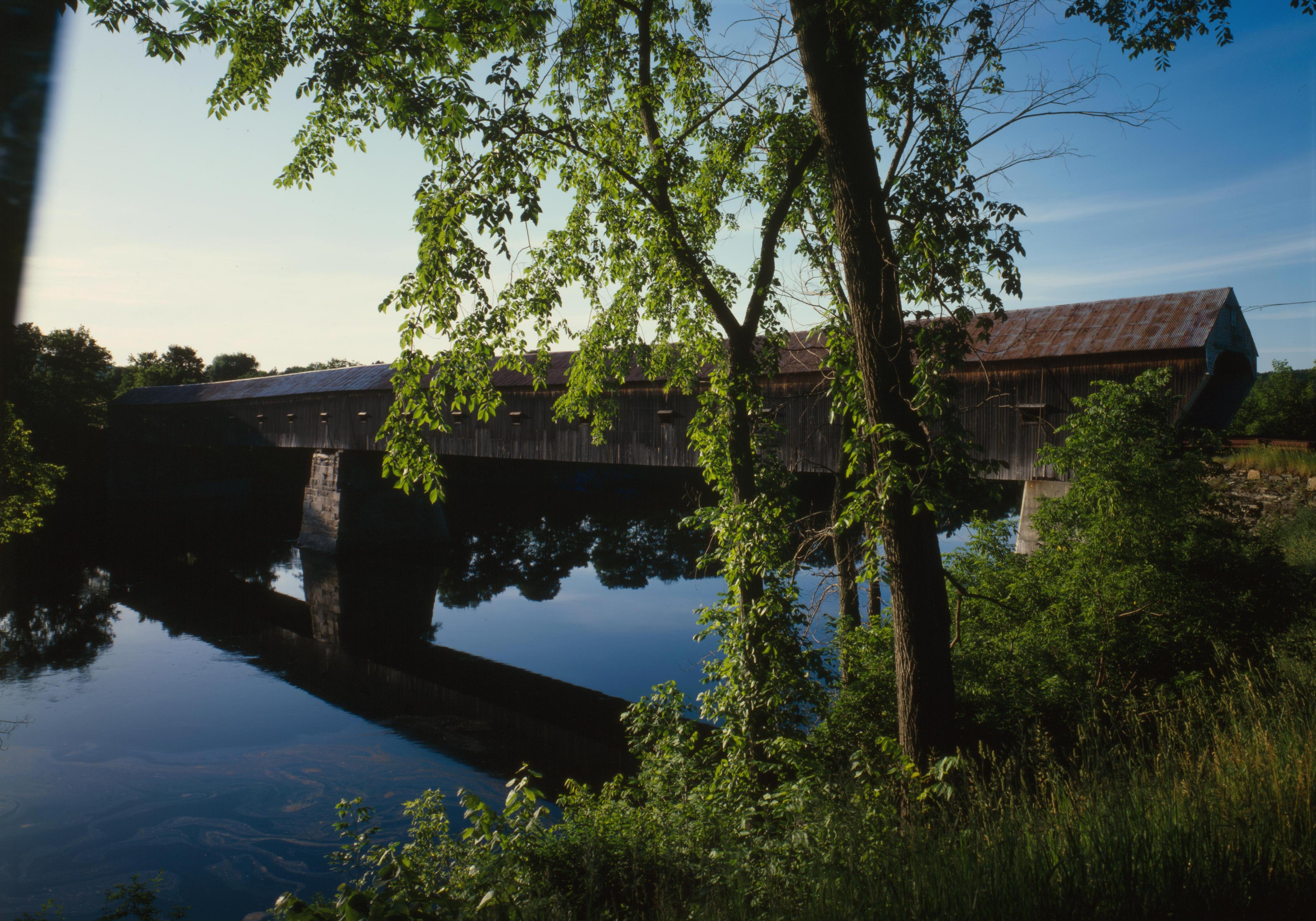
Dieses Bild zeigt ein Objekt, das im National Register of Historic Places der Vereinigten Staaten verzeichnet ist. Die Referenznummer lautet 76000135. |
| Kameraposition | | Dieses und weitere Bilder auf OpenStreetMap |
|---|
| Beschreibung |
English: Southern (downstream) side of the Cornish-Windsor Covered Bridge, which spans the end of the Zoarville Bridge, which spans the Connecticut River between Cornish, New Hampshire and Windsor, Vermont, in the United States. Built in 1866, it is listed on the National Register of Historic Places. |
|||||||||||||||||||||||
| Datum | ||||||||||||||||||||||||
| Quelle | Library of Congress, Prints and Photograph Division HAER: NH,10-CORN,2-11 | |||||||||||||||||||||||
| Urheber |
|
|||||||||||||||||||||||
| Genehmigung (Weiternutzung dieser Datei) |
|
|||||||||||||||||||||||
.jpg)

|
Dieses Bild ist unter der digitalen ID hhh.nh0177 in der Abteilung für Drucke und Fotografien der US-amerikanischen Library of Congress abrufbar.
Diese Markierung zeigt nicht den Urheberrechtsstatus des zugehörigen Werks an. Es ist in jedem Falle zusätzlich eine normale Lizenzvorlage erforderlich. Siehe Commons:Lizenzen für weitere Informationen.
|
Dateiversionen
Klicke auf einen Zeitpunkt, um diese Version zu laden.
| Version vom | Vorschaubild | Maße | Benutzer | Kommentar | |
|---|---|---|---|---|---|
| aktuell | 19:32, 6. Sep. 2009 | | 4.567 × 3.198 (1,49 MB) | Cropbot | upload cropped version, operated by User:Finavon. Summary: border cropped |
| 07:07, 14. Aug. 2009 |  | 4.911 × 3.556 (1,69 MB) | Nyttend | {{Location|43|28|26|N|72|23|1|W}} {{Information |Description={{en|Southern (downstream) side of the {{w|Cornish-Windsor Covered Bridge}}, which spans the end of the {{w|Zoarville Bridge}}, which spans the {{w|Connecticut River}} between {{w|Cornish, New H |
Dateiverwendung
Die folgende Seite verwendet diese Datei:
Globale Dateiverwendung
Die nachfolgenden anderen Wikis verwenden diese Datei:
- Verwendung auf ar.wikipedia.org
- Verwendung auf en.wikipedia.org
- Windsor, Vermont
- List of Historic Civil Engineering Landmarks
- National Register of Historic Places listings in Windsor County, Vermont
- Portal:U.S. roads/Did you know
- List of bridges on the National Register of Historic Places in New Hampshire
- List of bridges on the National Register of Historic Places in Vermont
- Portal:U.S. roads/Did you know/October 2011
- User:Eurodog/sandbox153
- Verwendung auf es.wikipedia.org
- Verwendung auf fr.wikipedia.org
- Verwendung auf vi.wikipedia.org
- Verwendung auf zh.wikipedia.org